How To Plan A Cycling Route
Planning ahead the route is without a doubt something very useful. Nowadays we have a bunch of applications which are specifically designed to plan cycling routes on our laptop or mobile and then have it on our GPSs
One of the options that the applications give us is to plan a route by choosing the start point and the end point or if it is a circular route, choosing the intermediate points of passage.
The application will propose a route between these points adapted to the type of cycling that we are going to practice, that is, for road it will propose a route with paved roads while for gravel it will use tracks and for Mountain Bike even trails.
We can modify the route proposed by the application to our liking and move the route along the paths that we like the most, making the route move adapting to our chosen sites.
On the map we can see favorite places or places highlighted by other users that usually come with a photograph and a description, if one is close to our route and we would like to go through it, we just have to click on it and say add it to our route .

Photo source: Online

Photo source: Online
Once the route is finished we can save it and we can transfer it to the GPS onboard computer, in my case a Hammerhead which is fully integrated with the major apps, and will give us step-by-step navigation of our route. We can also use it on the mobile where we can also download the offline maps if we want.

Photo source: Online

Photo source: Online
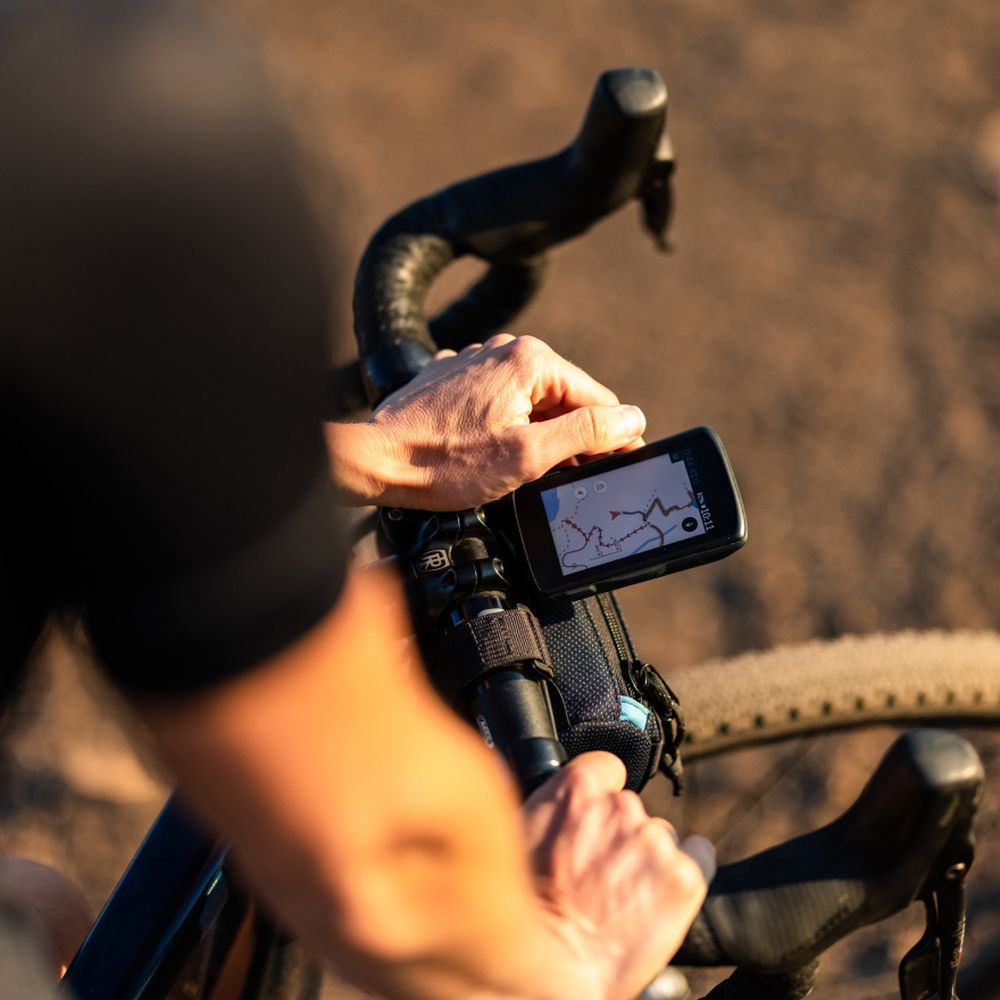
Photo source: Online
Another of apps features is that it gives us the option to view and download routes from a certain area that can inspire us for our outing or we will also get the routes made by the users we follow.
All the routes, both those planned by us and those of other users, come with complete information not only about altimetry but also about the surface on which it will be carried out and with an estimate of time.

Photo source: Online

Photo source: Online

Photo source: Online
Once we have made our route we can upload it to our profile together with all those photos and comments that we want, having the possibility of marking our favorite places and recommending them so that other users can benefit from that recommendation, if it is with a good photo and explanation better than better. The collaborative aspect of this application takes on great importance since, based on photos and comments from other users, we can decide where our route will take place.
The application is also a "social network" in which we can follow our friends and see their routes, as well as share routes with them and even invite them by sending the route we want to take, for example, next weekend.
RELATED ARTICLES
【Best Cycling Tours】
https://santic.com/blogs/extra/best-cycling-tours
【Cycling Climbs Guide】
https://santic.com/blogs/extra/cycling-climbs-guide
CYCLING GEAR SELECTION


